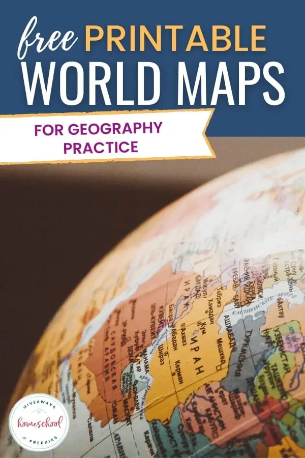
3 Free Printable World Maps Units for Geography Practice
Published:
July 14, 2022

Contributor:
Sarah Shelton
Disclosure: This post may contain affiliate links, meaning if you decide to make a purchase via my links, I may earn a commission at no additional cost to you. See my disclosure for more info.
Geography is such a fun topic to incorporate into your homeschool. A fun way to get children excited about the world around them is by incorporating printable world maps to look at and explore.
World Map for Kids
Do you have a world map for kids in your home? Maybe you have a giant wall map, a cartoon world map, or a map poster with lots of vibrant colors. Maps are a great way to to get your kids interested in learning about the different countries of the world.
Printable World Maps for Kids
You can find more than 1,000 free maps to print, including a printable world map with latitude and longitude and countries.
Printable World Map Activity – Print out this map with the continents to cut out and build Pangea with. This is a great hands-on geography activity for kids.
World Map for Kids – This world map for kids is full of animals, food, and symbols from all over the world and the different countries. It is exciting, colorful and fun.
FREE 7 Continents Resource Pack
Our 25-page printable pack of the 7 continents can be used by students of all ages. It includes a printable world map of the continents, labeling continent names, a continents worksheet for each continent, and notebooking report templates for habitats and animal research for each individual continent.
Resource?
Scroll to the bottom of this post to find out how to get your FREE copy of the 7 Continents Resource Pack today.
Maps of Continents
If you are learning about the different continents in the world you can also download a free continents and oceans worksheet.
World Continents Printable Maps and Quizzes – These activity sheets will have your children learn and label the different continents.
World Atlas Continents of the World – This map shows all the continents of the world with an equator line going through the middle.
World Maps with Names – Are you looking for a basic map to teach your kids about the continents? This map has colorful continents and lists the names of the oceans.
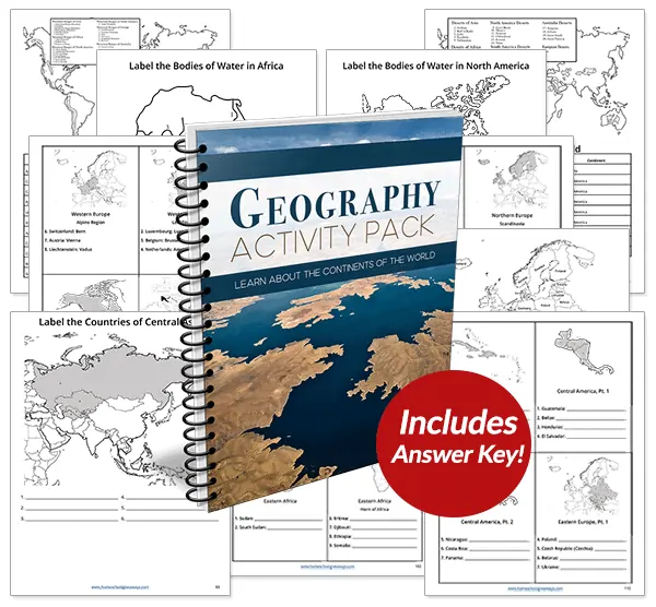
Recommended Resource: Geography Activity Pack
Students will explore every independent country in the world plus discover the most significant mountains, deserts, rivers, and lakes with this huge Geography Activity Pack.
Map of Africa
Be sure to print some free Africa worksheets to use alongside your study of Africa. You can also learn about plants and animals in Africa using open-and-go curriculum!
Political Map of Africa – This map of Africa shows the countries of Africa with their capital cities and bodies of water.
Map of Asia
Printable Maps of Asia – These printable maps show all the countries of Asia, plus a blank map for your children to label.
Map of North America
When you are studying the United States in your US geography curriculum, you should definitely print a map of North America. You can also download some free North America worksheets.
World Atlas Map of North America – An outlined map of North America for your children to label the states, capitals and major cities located in North America. You can also take it a step further and label locations of famous landmarks in the US.
Map of South America
Don’t forget about Central America! Explore some free Central America worksheets to enhance your geography lessons.
South America Map – This map shows the states of South America with national borders, capitals, rivers and lakes.
Map of Europe
Europe Countries Printables – Help your children learn all of the many different countries (or just the major countries) in Europe with a labeled map and blank map for your kids to fill out.
Map of Antarctica
Blank Map of Antarctica – This is a blank outline map of Antarctica that your kids can fill in the capitals and cities.
Map of Australia
Map of Australia Template – Cute map of Australia with a kangaroo and koala for kids to color and label.
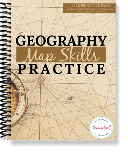
Free Map Skills Practice
Students will learn map vocabulary terms for cardinal directions, intermediate directions, compass rose, latitude, longitude, hemisphere and equator. Includes vocabulary cards and notebook pages for each term.
Resource?
Scroll to the bottom of this post to find out how to get your FREE copy of the Map Skills Practice today.
Continents and Oceans Map
Continents and Oceans of the World – Learn about the different oceans of the world and how they are laid out between the continents with these printable maps.
The Best Kids World Maps
Some of the best world maps for kids of all ages will have bright colors, fun illustrations and be exciting and intriguing to look at.
Illustrated Maps Of The World
Accurate World Map – This is an accurate world map created in a colorful vector illustration format.
Line Art World Map – Black and white line art vector illustration map that shows all of the continents in the world.
World Map for Kids with Cute Animals – Your younger children are going to have so much fun with this map that features animals from the countries they originate from.
World Map Coloring Pages
Globe Coloring Page – This printable globe coloring page that features the world map on the globe is a fun activity for kids to color.
National Geographic Coloring Map – Color the world with all of the flags from the different countries with this pdf download that will keep your children busy for hours.
World Map Coloring Pages – Teach your kids about world maps with this great variety of world map coloring pages that show the different countries and even teach latitude and longitude.
Free How to Read Maps Unit
With today’s GPS options, kids may wonder if they even need to know how to read maps or understand directions. The answer is YES! Maps are important, and you can help them learn how to understand them with this How to Read Maps Printable.
FREE Instant Download
How to Read Maps Unit
Maps for Kids FAQ
If you want to teach your kids about maps you may not know where to start. Here are some common questions about maps to give you a head start on some map learning fun for your small children.
How do you teach kids about maps?
You can teach kids about maps by showing them a map and explaining what the different parts of the map are. Show your children the different symbols and what they mean. Point out the state and country you live in and let them get familiar with what a map is and what it does.
What are the five parts of the map?
The five parts of the map are: the title heading of the map, compass rose, the grid with lines showing coordinates, the key and the scale.
How do I introduce a map to my students?
The best way to introduce a map is by hanging one up in your kids room to let them explore it on their own. Their young minds will be interested in the bright colors and the far off places and want to learn more. As they ask you questions you can begin to show them all of the different parts in a gentle way.
What are the main features of a map?
The main features of a map are found in many different maps. These are title, direction, legend, scale, labels, latitude and longitude.
What are the types of map?
The different types of maps that you will see used in geography studies are: political maps, physical maps, climate maps, topographic maps, road maps and thematic maps.
In Conclusion:
Teaching your kids about the maps of the world will help them with their geography practice and get them interested in the world we live in. You can have a lot of fun learning about the different types of maps and exploring them with your kids at home.

Grab 2 FREEBIES!
Our 7 Continents Resource and Map Skills Practice printable packs are currently available for FREE in the Subscriber Library.
Not already a subscriber? No problem. Simply enter your email below and we’ll get the current password. You’ll get access to this printable plus over 90 more HSG library resources for FREE!
Sarah Shelton
Sarah is a wife, daughter of the King and Mama to 4 children (two homeschool graduates) She is a an eclectic, Charlotte Mason style homeschooler that has been homeschooling for over 20 years. She is still trying to find the balance between work and keeping a home and gardens. She can only do it by the Grace of God, coffee and green juice!