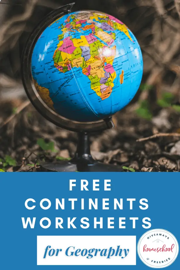
Free Continents & Oceans Worksheets for Geography
Published:
October 15, 2023
Contributor:
Sara Dennis
Disclosure: This post may contain affiliate links, meaning if you decide to make a purchase via my links, I may earn a commission at no additional cost to you. See my disclosure for more info.
Give your children a basic introduction of the continents, countries and oceans with these free worksheets designed for elementary aged children. Your children will love using a continent and oceans worksheet to learn all about the major oceans and locations of the continents in a fun way.
Continents & Oceans Worksheets for Geography
Continents are massive areas of land, separated by water or natural features. Oceans cover two-thirds of the world and oceans contain 97% of water on earth! We have created some amazing educational resources for you to add to your lesson plans to help you teach your students about the continents and oceans of our world.
How many Continents are there in the world?
There are seven continents of the world that cover one-third of the world. The names of the continents are:
- Africa
- Antarctica
- Asia
- Australia
- Europe
- North America
- South America
Continents don’t just include the landmass that’s in one large piece but also include any islands connected to it. For instance, Japan is considered a part of Asia while Greenland is considered part of North America.
This is because the continents are defined by their continental shelf that extends far out into the ocean. The continents cover approximately one-third of the world. In addition, each continent is bordered by at least one of the five oceans of the world.
How many Oceans are in the World?
There are five oceans in the world. Historically, there were originally 4 named oceans. The world’s oceans are the:
- Arctic Ocean
- Atlantic Ocean
- Indian Ocean
- Pacific Ocean
- Southern Ocean
The Southern Ocean is the newest named ocean named by National Geographic in 1999. Also known as the Antarctic ocean, this ocean is primarily located in the Southern hemisphere. It was given a formal name due to the conservation efforts surrounding its waters because it is home to marine life such as whales, penguins, and seals.
6 Different Layers of the Ocean
The oceans have several different layers based on the amount of sunlight each layer receives. Let’s tale a look at the different named layers of the ocean.
- Pelagic Zone: First, we have the column of open water from the surface of the ocean to the ocean floor. This is the pelagic zone.
- Sunlight Zone: The epipelagic covers the top of the pelagic zone, or the first 200 meters. It’s also called the sunlight zone.
- Mesopelagic Zone or the Twilight Zone: Next, there’s the mesopelagic zone or the twilight zone. While it receives some sunlight, the light is dim. It runs approximately from 200 meters to 1000 meters below the surface.
- Bathypelagic Zone or the Midnight Zone: The third zone is the bathypelagic zone or the midnight zone. It runs from 1000 – 4000 meters below the surface of the ocean.
- The Abyss: The Abyssopelagic zone, or the abyss, is the fourth layer. It drops from 4000-6000 meters below the surface.
- Hadalpelagic Zone: Finally, there’s the hadalpelagic zone or the trenches at the very bottom of the ocean.
Continents and Oceans Worksheets
Many families begin the study of world geography by studying the major oceans and continents. Kids can learn the location of the continents and oceans with continents worksheets and printable maps.
It’s a great way to begin studying a map of the world because there are not many continents and oceans to memorize. Also, kids need to know how to locate these places on a blank map.
Maps of Continents
You can begin developing these map skills by giving your kids a blank map and hoping they learn the locations. A better way to learn the continents and oceans is to use our 12-page Geography Map Skills Printable Pack as well as our 7 Continent Resource Printable Pack.
7 Continents Resource Pack
Our 25-page printable pack of the 7 continents can be used by students of all ages – even middle school students will enjoy them.
It includes a printable world map of the continents, labeling continent names, a continents worksheet for each continent, and notebooking report templates for habitats and animal research for each individual continent.
Resource?
Scroll to the bottom of this post to find out how to get your FREE copy of the 7 Continents Resource Pack today.
4 Books on Continents and Oceans for Kids
Another way to learn about continents and oceans is to read books. Here are 4 we found that may help kids learn more:
Kids Voyage to Seven Continents – Written by a homeschooling mom, this engaging book is full of interesting facts to get them excited for learning. There are even pages with vocabulary words and definitions for children to learn.
My First Book of Seven Continents – Include your little ones in your geography studies with this adorable book for toddlers.
National Geographic Kids World Atlas – A geography study isn’t complete without a nice, colorful and informative world atlas like this one from National Geographic.
Continents: What You Need to Know – Fun book of facts on the 7 continents that will engage your children, and wanting them to learn more.
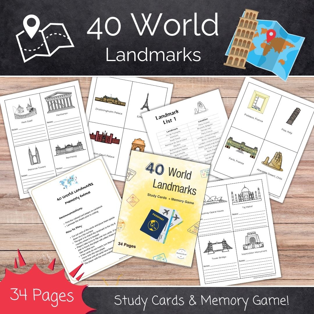
40 World Landmarks
World landmarks can be a great way to combine geography, history and even architecture into one lesson. And our 34 page printable is an easy way to quickly find 40 landmarks to start exploring.
Continents and Oceans Learning from Others
Simple Living Creative learning has 3 options to consider as well.
1. Continents and Oceans Printable Pack
This Continents and Oceans Printable Pack is aimed at children who are able to research the continents and oceans to find the answers. My thought is third grade or higher since kids need to be reading to learn rather than learning to read.
It contains a variety of activities which include:
- Naming the Continents on a world map
- Coloring the Continents on a world map
- Naming the Oceans on a world map
- Coloring the Oceans on a world map
- Reading and filling in the blank. There is one page for each of the Continents and each of the Oceans.
- Vocabulary cards about the continents – these cards come in color as well as black and white. Kids can use them to match the labels to the picture. You can also use the vocabulary cards for spelling and pronunciation practice.
2. Continents and Oceans Notebooking Pages
Older children who work well independently, may enjoy these Continents and Oceans Notebooking Pages.
This 70-page pack contains seven different notebooking pages for each continent. There are four different note booking pages for each ocean of the world. Included in these notebooking pages are maps of the seven continents.
There is also a map of each continent that has the country’s borders marked out on them. To go more in-depth, children can label each country if they wish, such as the United States. Another idea is to have your children locate the major mountain ranges and rivers on the world maps as well.
These notebooking pages will give kids ample space to write down the information they’ve researched, read, and learned about the continents and oceans.
3. Continent Cards
These Continent Cards from Simple Living Creative Learning are a great resource to introduce children to the seven Continents. The continent cards can be used by kids of all ages, even 2nd graders or younger. There are so many fun ways to use these cards to enhance learning.
- You can use them as flashcards for drills or simply assign them to your child to review every day.
- They can use these cards to learn the names and the shapes of each continent as well as the location of each continent on a world map.
- If you print two copies of these cards, children can use them for memory and matching games as well. Memory and matching games are a fun way to develop map skills.
Pop over now to Simple Living. Creative Learning to grab these resources in addition to our FREE resource pack below.
You Might Also Like…

Grab Your FREEBIE!
Our 7 Continents Resource Pack is currently available for FREE in our Subscriber Library.
Not already a subscriber? No problem. Sign up and get this printable plus over 90 more HSG library resources for FREE.