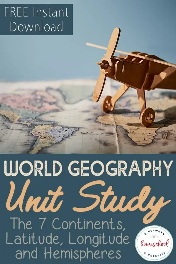
FREE World Geography Unit Study: The 7 Continents, Latitude, Longitude and Hemispheres
Published:
April 19, 2019

Contributor:
Sarah Shelton
Disclosure: This post may contain affiliate links, meaning if you decide to make a purchase via my links, I may earn a commission at no additional cost to you. See my disclosure for more info.
When I was in high school, my most dreaded subject was world geography and history. I was specifically confused by latitude and longitude, and I always tuned out the teacher. Determined to make geography a better experience for my kids, we have learned to enjoy learning about maps and locations all over the world.
World Geography Unit Studies
There are quite a few subjects in our homeschool that we enjoy using unit studies for, and these can be quite successful without a set curriculum or textbook. World Geography is one of those subjects that unit studies work really well with.
When you pick a specific continent and then choose countries in that continent to begin to study, everything just comes alive! There are so many things to see and learn about, that your children will be excited to learn geography.
I have put together a ton of resources for you to use with your children to help immerse them in world geography. I have broken them down by each one of the 7 continents. I have also included free printables and resources to help them understand latitude, longitude and hemispheres in a way that is not boring and dry, like most of us had to endure growing up!
Study of Continents
Explore our list of printables for the 7 continents worksheets below, broken down by continent.
FREEBIE?
We have a FREE download of our Learn the 7 Continents Pack available for you at the bottom of this post. Keep scrolling to get your copy today!
Asia Worksheets
- Printables for different countries in Asia; maps, flag notebooking sheets and more – Homeschool Creations
- Color the Continents: Asia – Education.com
- Activity Village tours the countries of Asia to bring you some interesting facts, flag printables, coloring pages, crafts, maps and worksheets.
- Mr. Donn has an entire page on the continent of Asia with teacher lesson plans, games, presentations, printables and resources.
- Outline Maps for Asia – World Atlas
- World Geography Asia Scavenger Hunt – Starts at Eight
- Asia Geography Worksheets Volume 1
- Asia Geography Worksheets Volume 2
Africa Worksheets
- Ancient Africa for Kids from Mr. Donn – there are country studies, African crafts, music and more.
- Africa Outline Map – World Atlas
- Africa Themed Pre Reading Cards Images of Africa – Welcome to Mommyhood
- Exploring Africa Online Curriculum – This curriculum is divided into units, modules, and learning activities.
- Exploring Africa Curriculum – divided into units with modules and various learning activities.
North America Worksheets
- Coloring Map of North America with fun facts and lots of geography information – Maps of World
- Ducksters North America Geography with countries, fun facts, maps and more.
- North and Central America Geography Scavenger Hunt – Starts at Eight
- North America Printables – 1+1+1=1
- Mr. Donn has an entire page on the continent of North America with teacher lesson plans, games, power point presentations, games, printables and more.
South America Worksheets
- South America coloring continent sheet
- Rivers of South America Outline Map
- South American Countries Map
- South America World Geography Scavenger Hunt from Starts at Eight
- South America Continent Study with free printables from Pinay Homeschooler
- South America Geography Games from A Spanish Mama
- Activity Village has a page for South America Geography with links to each country in South America, and facts and printable worksheets for each country.
- Enchanted Learning has a page full of printable South American maps for every country in South America.
- Mr. Donn has a South America Geography page that is full of games, power point presentations, teacher lesson plans and printables.
- South America Geography from Ducksters – this site is full of facts and information on South America, with continent and country maps and games and puzzles.
- Kids World Travel Guide has a South America Facts for Kids Page full of information and photos.
Antarctica Worksheets
- Outline Map of Antarctica
- Color the Continents: Antarctica
- Antarctica Lapbook from Homeschool Helper Online
- Animals of Antarctica Printable Cards – Imagine Our Life
- Enchanted Learning has an entire page of Antarctica facts, printable maps, worksheets and more.
Europe Worksheets
- Printable Map of Europe with Country Borders and Names – Free Us and World Maps
- Homeschool Creations has an entire page of European Country Printables.
- Activity Village tours the countries of Europe with interesting facts, flag printables, coloring pages, crafts and worksheets!
- World Geography Europe Scavenger Hunt from Starts at Eight
- Montessori Inspired Study of Europe with FREE Printables – Every Star is Different
- Mr. Donn has an entire page on the continent of Europe with free teacher lesson plans, games, presentations, printables and resources.
- National Geographic Travel is full of Europe travel information, photos and facts.
Australia Worksheets
- Australia Maps – World Atlas
- Australia Blank Outline Map – Maps of the World
- Australia Continent Animal Coloring Page – Education.com
- Australia Geography Printables – Homeschool Creations
- Australia Themed FREE Printables – Montessori Nature
- National Geographic Travel is full of Australia travel information, photos and facts.
- Ed Helper has an entire page of an Australia Themed Unit with printable books, printable maps, leveled readers, geography quizzes and more.
- Mr. Donn has an entire page on the continent of Australia with teacher lesson plans, games, presentations, printables and resources.
Latitude and Longitude Worksheets
- Hemispheres Map – Printable World Map
- The Northern and Southern Hemispheres Worksheet – Education.com
- Latitude and Longitude Printable Mini Unit – Raising a Self Reliant Child
- Latitude and Longitude Bingo Game
- Learn About Hemispsheres by creating a mini book – Practical Pages
- Our Free Geography Terminology Copywork Notebook will teach your children the difference between latitude and longitude, as well as having them learn 40 different key geography terms while they are practicing their handwriting and copying them all down in their notebook.
Free Seven Continents Printable Pack
Use our notebooking pages to learn about the seven continents by looking up latitudes and longitudes, labeling a map, and more! This is a FREE instant download, no email opt-in is necessary.
You Might Also Like…
FREE Instant Download
Learn the 7 Continents Pack
Sarah Shelton
Sarah is a wife, daughter of the King and Mama to 4 children (two homeschool graduates) She is a an eclectic, Charlotte Mason style homeschooler that has been homeschooling for over 20 years. She is still trying to find the balance between work and keeping a home and gardens. She can only do it by the Grace of God, coffee and green juice!