Free Giant Maps for Your Homeschool
Published:
May 22, 2020

Contributor:
Carrie
Disclosure: This post may contain affiliate links, meaning if you decide to make a purchase via my links, I may earn a commission at no additional cost to you. See my disclosure for more info.
Everyone is familiar with using maps in geography, but did you know you can use them to teach many different subjects? I found this incredible giant map site that has table-sized or even floor-sized maps you can print FREE! Let’s look at some of the ways you can use Free Giant Maps for Your Homeschool.
I’m excited to share how you can incorporate the use of Free Giant Maps for Your Homeschool. There are tons of ways you can use this site! Please note, some of the pages on this website reference evolution, so please use discretion when using information other than the maps themselves.
In the Online Interactive Maps section and the Map Puzzles section, kids can play interactive games where they drag countries or capitals to the correct places on a map.
Kids can test their knowledge of US geography with more than 1,000 questions in the US Geography Mega Quiz. Each question comes up next to an interactive map of the United States where students can click on the correct answer.
You can print labeled or unlabeled maps of each state through their Printable U.S. State Maps option. The website indicates that you can print the maps for personal or classroom use.
You can view maps of many countries with the Online Atlas.
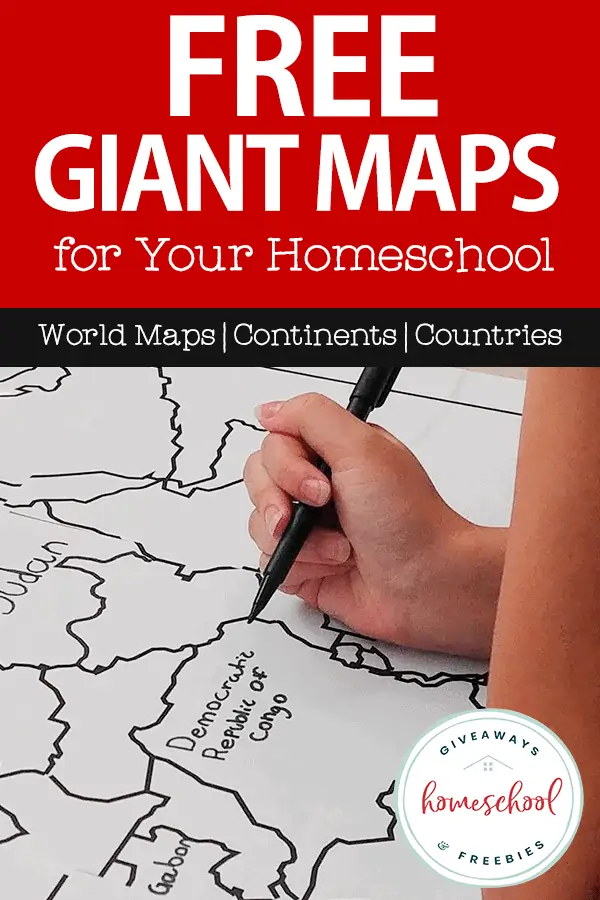
But my favorite part is where you can Print Free Maps Large or Small. We decided to explore Africa since we are going through the unit study on Africa from Gather ‘Round Homeschool.
We have been learning about one new country a day and it’s been a lot of fun learning about the different African cultures. Some of the countries in Africa are very small, so a giant sized map of Africa made labeling them so much easier!
Here are the steps I took to print a large map of Africa for our unit study:
- Visited Owl & Mouse at this link
- Clicked Print Maps of Africa and African Countries
- Selected Africa as a whole
- Chose 3×3 – 9 pages (if you want it larger, you can select up to 8×8, which would use 64 pages and take up an entire room)
- Printed, trimmed, and taped on the backside
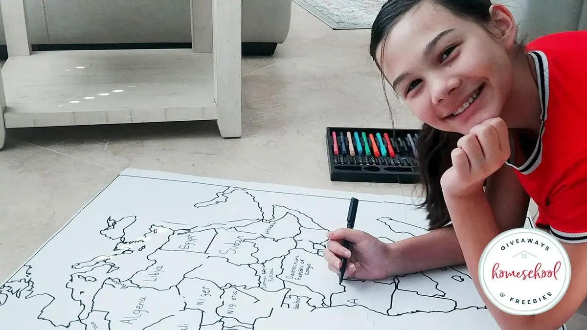
There are so many ways you can have fun with these! The easiest way to get started is to copy country names, capitals, and major geography features. This is a great way to practice handwriting and spelling.
You can go deeper with your geography and social studies work by printing country flags to tape or paste onto your map. You’ll find a free collection of world maps you can print in the CIA World Factbook.
Go deeper still by adding U.S. or world landmarks to your map. We have FREE printable Architects and U.S. Landmarks Fact Cards and Architects and World Landmarks Fact Cards. You can print these for review and use the images in them as examples for your kids to copy onto their maps.
What about history? Using an encyclopedia or Internet source, have your kids look up each capital city and write the year the city was founded next to it on the map. For our map of Africa, for example, we could discover that Addis Ababa, the capital of Ethiopia, was founded in 1887 by Menelik II.
You can use giant maps to spark Bible study as well. Use a concordance to find verses related to a location or the nations in general. For our map, we would find many references to Egypt, or you can search “nation,” “peoples,” etc. and find verses such as Matthew 28:19-20 or Acts 17:26. Have your kids write the verse on their map.
Believe it or not, you can work math and science into your map study, too! Using an atlas, have your kids calculate the distance between various points and calculate the distance using the scale. They can write a few of the distances they calculate on their map.
To add some science, kids can use an encyclopedia or Internet source to look up what biomes and habitats can be found in the area you are studying. Have them choose a few of the animals or plants from these areas and draw them on their map.
You might also want to grab this FREE U.S. State Flags Worksheets & Fact Cards.
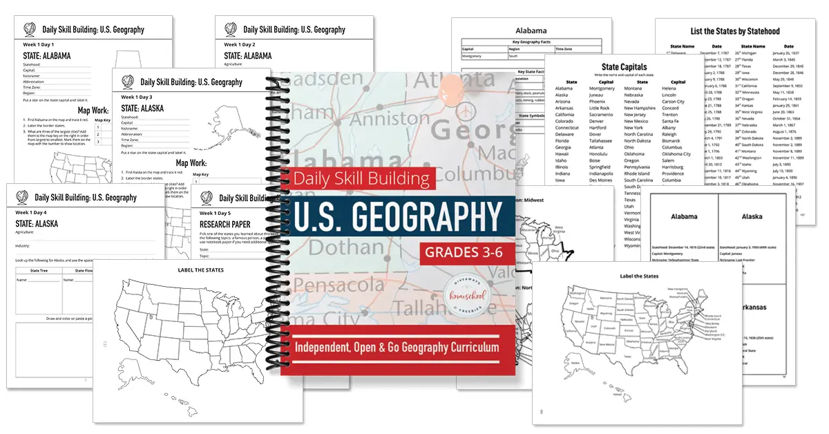
Are you looking for an easy-to-use U.S geography curriculum for your elementary students?
Daily Skill Building: U.S. Geography is just one sheet a day, requires no teacher’s guide, AND includes answer keys! You can open and go with this elementary geography curriculum. Check out a a full week sample plus the extra resource pack.
Click here to explore the many printable map options for your homeschool.
Carrie
Carrie Fernandez is the owner of Daily Skill Building. She has been homeschooling for over 18 years, has two girls and works side by side at home with her awesome husband. She has been saved by grace, fails daily, but continues to strive toward the prize of the high calling of being a daughter of the Most High God.