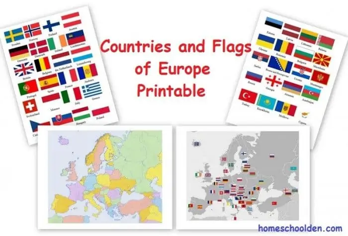
FREE Geography Printable Pack – Maps and Flags of Europe
Published:
January 3, 2017

Contributor:
Carrie
Disclosure: This post may contain affiliate links, meaning if you decide to make a purchase via my links, I may earn a commission at no additional cost to you. See my disclosure for more info.
A study on European geography isn’t complete without flags and maps. Both of these are now at your disposal with these beautiful, free printables! (There are eight printables in all.)
There are also instructions for making a pin map with layers of foam. This is sure to heighten the interest of the project for your child which will naturally encourage learning!
Carrie
Carrie Fernandez is the founder of Homeschool Giveaways and owner of Daily Skill Building. She has been homeschooling for over 18 years, has two girls and works side by side at home with her awesome husband. She has been saved by grace, fails daily, but continues to strive toward the prize of the high calling of being a daughter of the Most High God.